Population Assessments
Using drones and other remote sensing techniques to study the density and distribution of seabird colonies, pinniped rookeries, turtles, and sharks

How many are there?
One of the most frequent uses of UAS in marine science and conservation is for assessing the abundance and density of marine organisms. The MaRRS lab uses drones to count seabirds, pinnipeds, sea turtles, and sharks. Other researchers use them to count dugongs, intertidal invertebrates and some species of jellyfish. In many cases, these assessments are done using fixed-wing UAS, although multirotor UASs are also employed for these purposes. A variety of sensors are applied to these tasks to help identify organisms. For example, for mammals and birds, thermal cameras can be helpful.
Below are links to several of our published studies that illustrate how we use drones for population assessments in marine science and conservation.
Seymour, A., Dale, J., Hammill, M. et al.Automated detection and enumeration of marine wildlife using unmanned aircraft systems (UAS) and thermal imagery
Sci Rep 7, 45127 (2017). https://doi.org/10.1038/srep45127
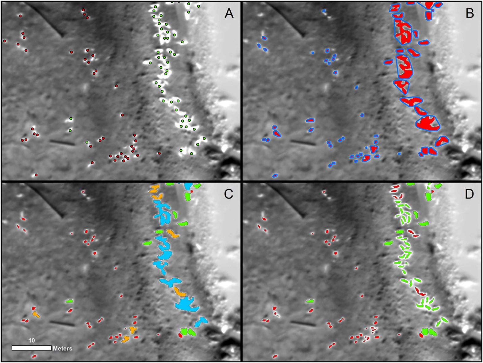
Estimating animal populations is critical for wildlife management. Aerial surveys are used for generating population estimates, but can be hampered by cost, logistical complexity, and human risk. Additionally, human counts of organisms in aerial imagery can be tedious and subjective. Automated approaches show promise, but can be constrained by long setup times and difficulty discriminating animals in aggregations. We combine unmanned aircraft systems (UAS), thermal imagery and computer vision to improve traditional wildlife survey methods. During spring 2015, we flew fixed-wing UAS equipped with thermal sensors, imaging two grey seal (Halichoerus grypus) breeding colonies in eastern Canada. Human analysts counted and classified individual seals in imagery manually. Concurrently, an automated classification and detection algorithm discriminated seals based upon temperature, size, and shape of thermal signatures. Automated counts were within 95–98% of human estimates; at Saddle Island, the model estimated 894 seals compared to analyst counts of 913, and at Hay Island estimated 2188 seals compared to analysts’ 2311. The algorithm improves upon shortcomings of computer vision by effectively recognizing seals in aggregations while keeping model setup time minimal. Our study illustrates how UAS, thermal imagery, and automated detection can be combined to efficiently collect population data critical to wildlife management.
DiGiacomo, A.E.; Harrison, W.E.; Johnston, D.W.; Ridge, J.T. . Drones 2020, 4, 74.Elasmobranch Use of Nearshore Estuarine Habitats Responds to Fine-Scale, Intra-Seasonal Environmental Variation: Observing Coastal Shark Density in a Temperate Estuary Utilizing Unoccupied Aircraft Systems (UAS)
Drones 2020, 4, 74. https://doi.org/10.3390/drones4040074
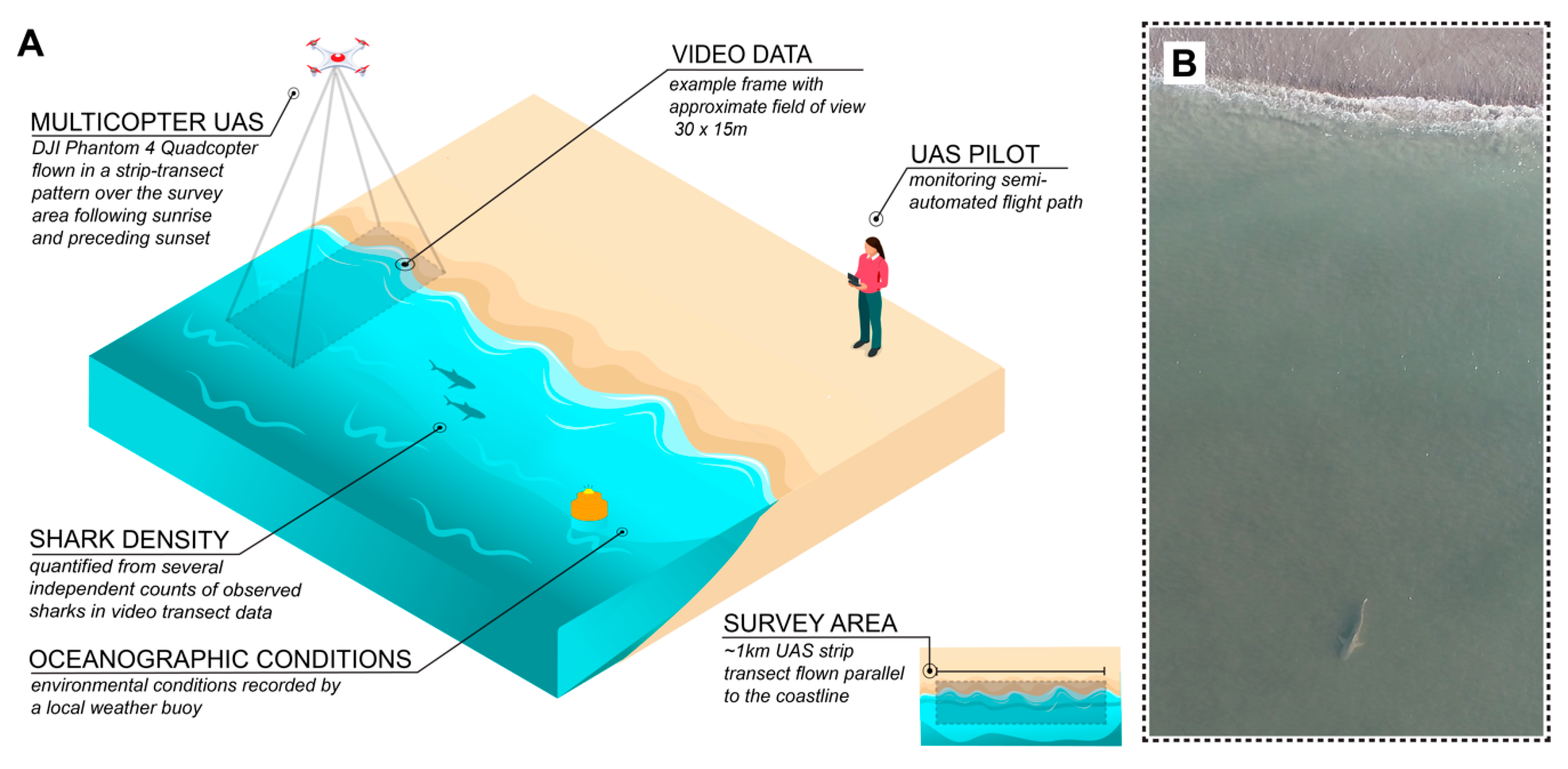
Many coastal shark species are known to use estuaries of the coastal southeastern United States for essential purposes like foraging, reproducing, and protection from predation. Temperate estuarine landscapes, such as the Rachel Carson Reserve (RCR) in Beaufort, NC, are dynamic habitat mosaics that experience fluctuations in physical and chemical oceanographic properties on various temporal and spatial scales. These patterns in abiotic conditions play an important role in determining species movement. The goal of this study was to understand the impact of environmental conditions around the RCR on shark density within the high-abundance summer season. Unoccupied Aircraft System (UAS) surveys of coastal habitats within the reserve were used to quantify shark density across varying environmental conditions. A combination of correlation analyses and Generalized Linear Modelling (GLM) revealed that density differs substantially across study sites and increases with rising water temperatures, conclusions that are supported by previous work in similar habitats. Additionally, density appears to increase moving towards dawn and dusk, potentially supporting crepuscular activity in coastal estuarine areas. By describing shark density dynamics in the RCR, this study provides new information on this population and presents a novel framework for studying elasmobranchs in temperate estuaries.
Sykora-Bodie, S.T., Bezy, V., Johnston, D.W. et al. Quantifying Nearshore Sea Turtle Densities: Applications of Unmanned Aerial Systems for Population Assessments.
Sci Rep 7, 17690 (2017). https://doi.org/10.1038/s41598-017-17719-x
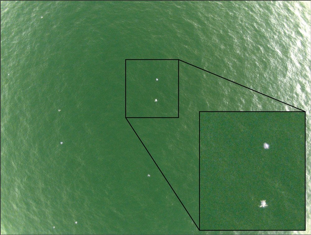
Although sea turtles face significant pressure from human activities, some populations are recovering due to conservation programs, bans on the trade of turtle products, and reductions in bycatch. While these trends are encouraging, the status of many populations remains unknown and scientific monitoring is needed to inform conservation and management decisions. To address these gaps, this study presents methods for using unmanned aerial systems (UAS) to conduct population assessments. Using a fixed-wing UAS and a modified strip-transect method, we conducted aerial surveys along a three-kilometer track line at Ostional, Costa Rica during a mass-nesting event of olive ridley turtles (Lepidochelys olivacea). We visually assessed images collected during six transects for sea turtle presence, resulting in 682 certain detections. A cumulative total of 1091 certain and probable turtles were detected in the collected imagery. Using these data, we calculate estimates of sea turtle density (km−2) in nearshore waters. After adjusting for both availability and perception biases, we developed a low-end estimate of 1299 ± 458 and a high-end estimate of 2086 ± 803 turtles km−2. This pilot study illustrates how UAS can be used to conduct robust, safe, and cost-effective population assessments of sea turtle populations in coastal marine ecosystems.


